The Grain Elevators Are the Landmarks
Before GPS, the elevators told you exactly where you were
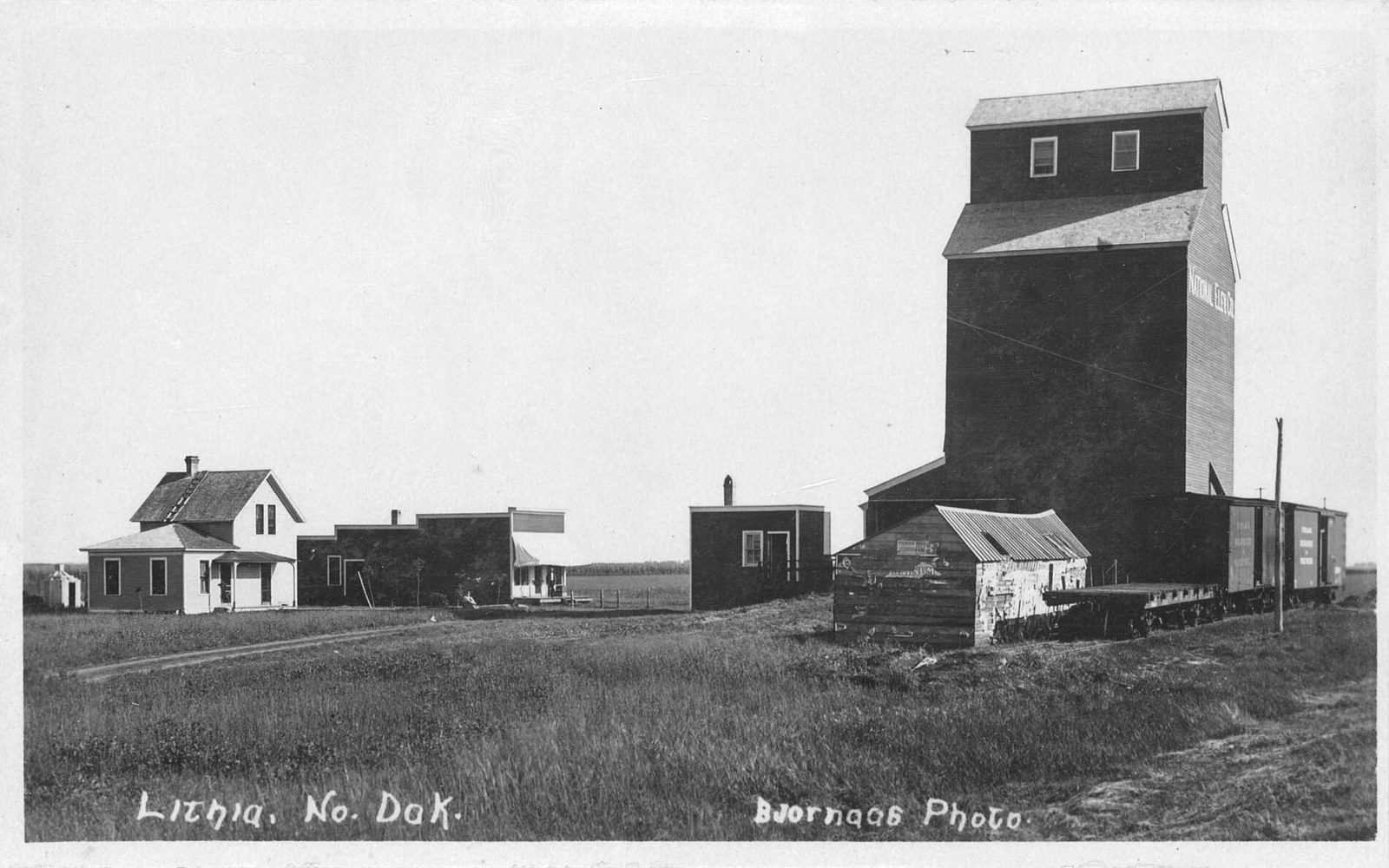
Out here, grain elevators are navigation. On flat ground with sight lines that stretch ten miles, a cluster of white cylinders rising above a cottonwood break means a town is coming — and if you know the country, you can tell which one. The elevator profile is as distinct as a skyline: how many legs, how tall, whether there is a flat-sided annex or a corrugated steel addition, whether the cooperative name painted down the side has been refreshed or left to weather. Locals read these things the way sailors read headlands.1 Visitors can learn quickly.
McLean County runs across a wide stretch of central North Dakota where the Missouri bends north, where the prairie rolls into breaks, and where grain farming and lignite coal have shaped the economy in roughly equal parts for more than a century. The towns that emerged along the railroads and highways are small — most measure their populations in the hundreds — and they do not look alike if you pay attention. The elevator is the first clue, and once you are on main street, everything else follows from it.
What the elevator tells you before you arrive
The functional logic is simple: grain elevators were built where the railroad ran, and railroads ran where developers drew lines on territorial maps. Each elevator served a service radius of roughly half a day's wagon travel, which is why the towns of McLean County sit at intervals that feel almost metronomic along the old rail corridors. Underwood, Garrison, Coleharbor, Max — spaced apart with the regularity of a land survey, because that is exactly what created them. The section line grid, running true to the cardinal directions across the county's gravel roads, feeds grain to these central points the same way it always has, only now by truck rather than by team and wagon.
What has changed is the scale. The low wooden elevators that served early homesteaders were replaced over decades by concrete and steel structures engineered for volume. A modern concrete leg in McLean County can hold hundreds of thousands of bushels — the kind of capacity that would have seemed impossible to the original homesteaders. Some towns have seen their elevator infrastructure consolidated as farms grew larger and smaller operators merged into regional cooperatives. A few of the old wooden structures still stand in various states of use or disuse; they tend to be the ones worth photographing, their board-and-batten sides silvered by decades of weather.
The working elevators, the ones that still take in wheat and corn and sunflowers every fall, are a different kind of photographic subject: active, dusty, loud during harvest, surrounded by grain trucks queued along the highway approach. Pull off the road during harvest and watch for ten minutes.2 The precision of the operation — trucks weighed in, augered out, tickets printed, trucks weighed again — is its own kind of industrial choreography.
Town by town, the view changes
Washburn sits on the Missouri River and has always been the county seat, which gives it a civic gravity the other towns lack. Its elevator presence is real but not dominant; what reads on the horizon here is the courthouse and the water tower before you reach the grain storage. Washburn also holds the Lewis and Clark Interpretive Center, which makes it the most historically layered stop in the county. The river is close enough to smell when the wind is right.
Garrison is the lake town, oriented toward Lake Sakakawea and the recreation economy that the Garrison Dam created. Its elevator still stands and still works, but the visual identity of Garrison competes with bait shops and boat dealers and the famous roadside walleye that greets visitors from the main intersection. The elevator here is context, not centerpiece.
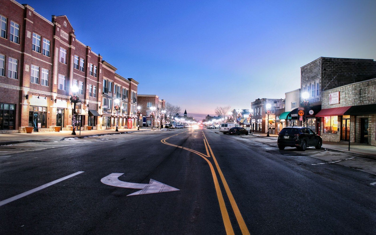
Underwood has one of the more intact main streets in the county — a real commercial block, a few operational storefronts, a bar where people actually drink. The elevator there anchors the north end of town the way a church anchors the south, and the symmetry is not accidental. In small prairie towns the grain elevator and the church were often the two largest structures, competing gently for vertical supremacy and performing entirely different kinds of community service.
Coleharbor sits near the south shore of Lake Audubon, close enough to the Audubon National Wildlife Refuge that the surrounding landscape in migration season is more about birds than bushels. The elevator here feels almost incidental to the wetlands and the open water nearby — but it is still the thing that tells you Coleharbor is coming when you are driving in on the highway.
Max, out in the pothole country north of the lake, wears its agricultural identity plainly. The elevator at Max is visible from a significant distance on the flat approach roads, a white column against whatever the sky is doing that day. Max and the nearby town of Turtle Lake are farm towns in the unvarnished sense: the businesses that remain are the ones farms need, and the visual vocabulary is all grain and equipment and weather.
Riverdale, by contrast, is an outlier. Built by the federal government to house workers during the construction of Garrison Dam and still bearing that planned-community geometry, Riverdale's skyline reads differently from any other town in the county. There is an elevator near Riverdale, but the town itself was never really an agricultural hub — it was and remains an infrastructure town, shaped by the dam and the Missouri River Project rather than by the rail and wheat economy that created everywhere else.
The skyline as a kind of calendar
Elevator towns run on agricultural time, and the skyline tells you where in the season you are. In late July the country looks lush and the elevators stand half-empty after spring movement. By October the bins are full, the truck traffic is heavy on the section line roads, and the smell of freshly augered grain drifts across every town in the county. By January the movement quiets; grain has gone to rail or barge, and the elevators hold winter stock or stand waiting for spring wheat. The structures themselves do not change, but their meaning does.
None of this is picturesque in a conventional sense. There are no dramatic peaks, no signature bridges, no skyline in the urban sense of the word. What there is instead is a legible landscape — one where the built environment grew directly from the land's productivity, where every tall structure has an economic reason for standing where it stands, and where once you learn to read the cylinders and the headhouse and the catwalk you can navigate a hundred miles of central North Dakota without consulting a phone. The elevators are the landmarks because they were built to be seen.3 They still are.
How it happened
- territorial erarailroads platted towns at wagon-radius intervals, placing elevators at each
- early homestead erawooden elevators served original settlers
- mid-20th centuryconcrete and steel elevators replaced older wooden structures at scale
- dam-construction eraRiverdale established as planned infrastructure town outside the grain economy
End-notes
Asides from the editors — the things that did not belong in the piece itself.
It takes about a week of driving before you start doing this without meaning to. It is the most useful thing this county teaches a visitor, and nobody will ever teach it to you directly. ↩ back
Stand where the operator can see you and well out of the truck lane. Nobody out here minds an audience; everybody minds a hazard. ↩ back
Which is more than can be said for most things built to be looked at. ↩ back